Accessibility and Language Options(Opens in new window.)
Stations


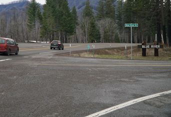
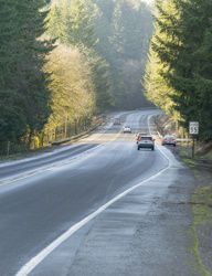
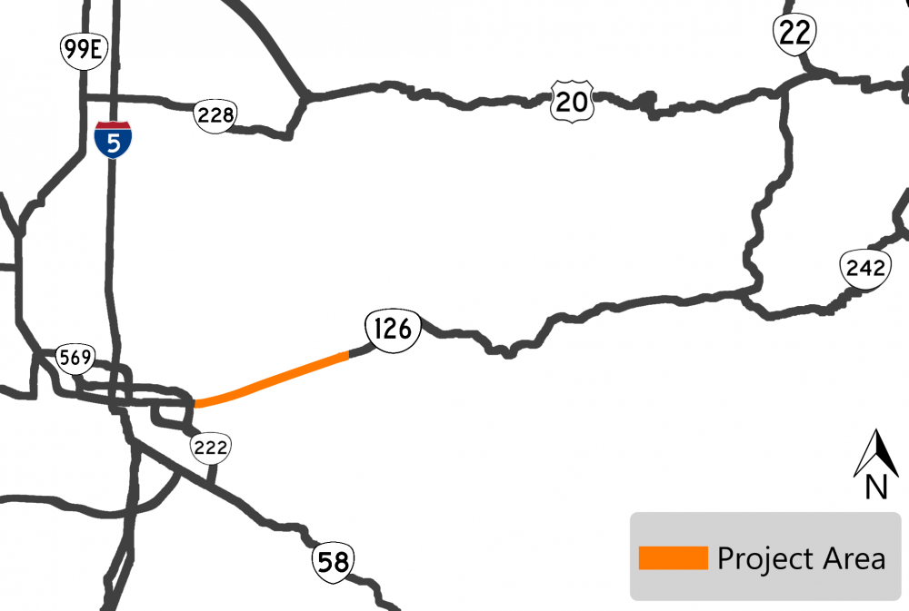
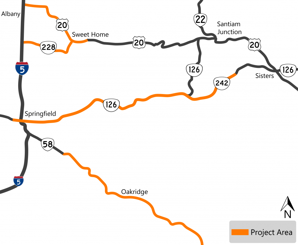
![]() In recent years, safety has become an increasing concern for the local communities and people who frequently use this route, especially after the 2020 Holiday Farm Fire.
In recent years, safety has become an increasing concern for the local communities and people who frequently use this route, especially after the 2020 Holiday Farm Fire.
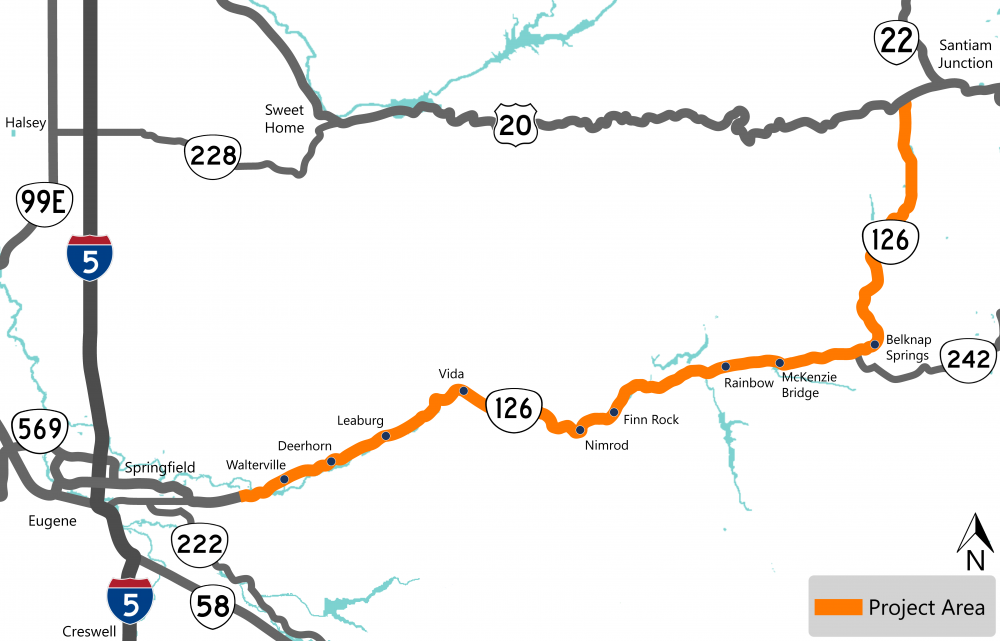
To better understand the needs along the corridor, we examined the corridor’s crash history and gathered public feedback on existing safety issues. We then identified nine locations to focus on.
We're now considering short-term and low-cost potential solutions for each location that can be implemented in the next five years. We're also looking at some corridor-wide solutions, including rumble strips and curve warning signs.
The study won't result in specific projects until funding becomes available.
In-Person Open House
Your feedback is an important part of our process. It will help us identify the right solutions for your community.
Stop by our in-person event to learn more about the safety study, projects we're constructing this year and projects that are currently being designed.
-
When: Thursday, July 13 from 6 p.m. to 7:30 p.m.
Drop in at any time! -
Where: McKenzie Fire and Rescue Station, 42870 McKenzie Hwy, Leaburg, OR 97489.
We hope you can stop by. Please let us know if you need accommodations to attend.

Add the In-Person Open House to Your Calendar
Add to Google Calendar | Add to Outlook.com Calendar | Download and add to Apple Mail or Outlook Desktop Calendar
Click the "+" or the title below to view the information in each section.
Access to Recreational Destinations
 OR 126 provides access to many recreational destinations, river rafting areas, campgrounds and hiking trails.
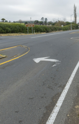
There aren't consistent signs to alert drivers of entrances. This causes drivers to slow down to look for their destination or make sudden turns.
The accesses are difficult to see, so it can surprise drivers on OR 126 as vehicles exit these locations.
Potential Solutions
Click on each tab below to learn more about potential solutions.
We don't have funding for these solutions as part of the study.
If funding became available, the cost and time it takes to implement would depend on the chosen solution.
Delineators to Define Driveways and Intersections
 About
About
To help make accesses more visible to drivers, we could install delineators at driveways or intersections. Delineators are reflective devices mounted above the surface of the road to help visually guide the driver.
Benefits
Delineators could increase the visibility and awareness for drivers if installed consistently throughout the corridor. With more advanced warning, drivers may slow down and be less likely to make sudden turns.
Defining Access Points
 About
About
There are many places where vehicles can enter and exit the highway, we looked at ways to make these accesses more visible to drivers. To define access points we could:
- Install curbs or paint.
- Encourage appropriate use of parking areas along the side of the road.
- Add signs to make parking areas more visible.
- Partner with other agencies to encourage defined parking areas near destinations.
Benefits
These methods could mean fewer conflict points along the corridor and more awareness that drivers may make turns off of and onto OR 126.
Install Warning Signs
 About
About
To help make access locations clear, we could install more warning signs consistently throughout the corridor. These signs may include:
- Advanced pedestrian warning signs.
- Congestion ahead warning signs.
- Advance intersection warning signs.
- Destination signs for recreational areas or trailheads.
- Street name signs on both sides of the road.
- More frequent milepost signs so it is easier to locate destinations and report incidents.
Benefits
More warning signs along the corridor could increase driver awareness and reduce sudden and unexpected reactions.
Encourage Slower Speeds
 About
About
To help encourage drivers to slow down, especially near recreational destinations, we could:
- Install signs that inform drivers they're entering a community.
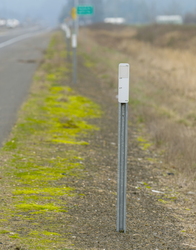
- Install speed feedback signs that notify drivers how fast they're going.
- Where possible, change the layout of the road by adding larger shoulders or eliminating passing zones.
- Where possible, we could look at reviewing speed limits.
Benefits
Signs alerting drivers how fast they're going and reminding them that they're in a community could help encourage them to slow down. Larger shoulders and eliminating passing zones near driveways and accesses could minimize potential conflicts.
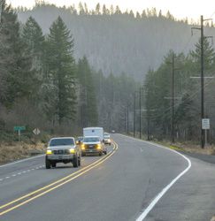
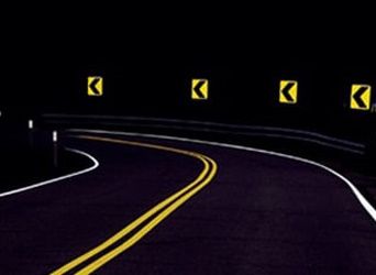
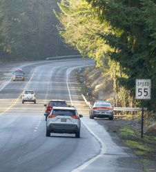
Curves in the Road
 OR 126 has many curves. At some locations, there's a pattern of drivers leaving the road or crossing the centerline when curves and other conditions exist.
Examples of those conditions are:
-
Hills.
-
Snow, ice and wet pavement.
-
Passing lanes that are within curves.
-
Pull-outs in curves with limited sight distance, meaning drivers can't see very far ahead of them.
Drivers have shared that visibility can be poor due to curves, hills and trees.
Potential Solutions
Click on each tab below to learn more about potential solutions.
We don't have funding for these solutions as part of the study.
If funding became available, the cost and time it takes to implement would depend on the chosen solution.
Delineators Along Curves
About
To help make curves in the road more visible to drivers, we could install delineators on both sides of the road defining the curves. Delineators are reflective devices mounted above the surface of the road to help visually guide the driver. We could also install them on the existing guardrail.
Benefits
Delineators could increase the visibility and awareness for drivers if installed consistently throughout the corridor. With more advanced warning, drivers may slow down and be less likely to make sudden turns.
Shoulder Rumble Strips
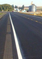 About
About
We could add rumble strips along the outside of the travel lane, or shoulders, to help drivers be more aware if they're leaving the road. Rumble strips are grooves cut into the pavement that make a sound and vibration when you drive on them.
Benefits
Shoulder rumble strips help reduce run-off-the-road type crashes. Rumble strips alert drivers when they're leaving their lane so that they have time to return.
Centerline Rumble Strips
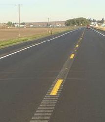 About
About
We could add rumble strips along the center of the road to help drivers be more aware if they're leaving their lane and crossing into oncoming traffic. Rumble strips are grooves cut into the pavement that make a sound and vibration when travelers drive on them.
Benefits
Rumble strips through the center of the road help reduce head-on and sideswipe crashes. Ruble strips alert drivers when they're leaving their lane so that they have time to return.
Passing Lanes
 Passing lanes are located throughout the corridor and help keep traffic moving. Several of the passing lanes aren't long enough to meet current standards. Many passing lanes are located within curves where crashes have been reported.
Risky driver behavior has been tied to a lack of opportunity to pass slower-moving vehicles. People mentioned that some turnouts are not paved or there isn’t enough warning to be able to use them safely.
Potential Solutions
Click on each tab below to learn more about potential solutions.
We don't have funding for these solutions as part of the study.
If funding became available, the cost and time it takes to implement would depend on the chosen solution.
Signs and Paint
 About
About
We could install consistent signs and paint along the corridor to make sure drivers can see passing lanes and turnouts.
Benefits
This would provide drivers with consistent information along the corridor so they know when passing opportunities are coming and when passing lanes will end.
Evaluate Existing Passing Lanes
 About
About
We could complete a new study to evaluate the existing passing lanes in the corridor. This study would look at the lengths, taper lengths and other conditions within the passing lanes compared to current standards.
Benefits
A study like this would help us identify the needs and opportunities to provide passing lanes that minimize risky driver behavior.
Modify Passing Lanes
 About
About
We could modify existing passing lanes by making them longer or shorter, shifting their location or by removing them.
Benefits
Passing lane start and end points could be shifted to separate the passing lanes from driveways, reducing the risk of conflicts between drivers speeding up to pass and drivers slowing to turn into driveways. Making passing lanes longer also gives drivers more time to complete their movement.
Places where passing lanes are shortened or removed could be maintained as a wider shoulder where disabled vehicles could safely pull off the road or a safe place for emergency and enforcement vehicles.
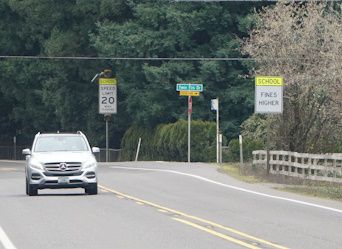
Roadway Conditions
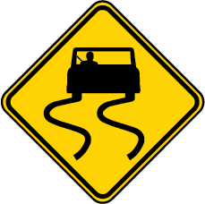 Some locations along the highway are more difficult to navigate safely.
During our outreach, people shared that:
- When it's dark or the road is wet there are more safety challenges, because it's harder to see signs and striping.
- Trees and shrubs that used to serve as a visual and physical buffer in the landscape are now gone after recent fires. Without this buffer, drivers feel less safe and comfortable in these areas.
- Steep drop-offs, narrow lanes and other objects along the road create possible hazards for drivers.
Potential Solutions
Click on each tab below to learn more about potential solutions.
We don't have funding for these solutions as part of the study.
If funding became available, the cost and time it takes to implement would depend on the chosen solution.
Update Missing or Old Reflective Markings and Signs
 About
About
We could update old or replace missing reflective markings and signs along the corridor. This could include:
- Reflective striping.
- Reflective signs.
- Delineators.
- Recessed pavement markers.
- Milepost signs.
Benefits
By updating old and replacing missing markers and signs, drivers would have more awareness and visibility when it is dark or the road is wet.
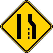
Road Narrowing Warning Signs
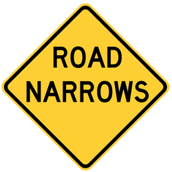 About
About
We could install warning signs that notify drivers that the road is narrowing ahead.
Benefits
These warning signs could alert drivers to be more cautious:
- Vehicles may slow down as the lane narrows.
- Drivers could better anticipate that vehicles ahead are slowing down.
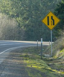
Narrow Bridge Warning Signs
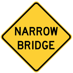 About
About
We could install warning signs that notify drivers that there is a narrow bridge ahead.
Benefits
These warning signs could alert drivers to be more cautious:
- Vehicles may slow down as they approach the narrow bridge.
- Drivers could better anticipate that vehicles ahead are slowing down.
Install Guardrail
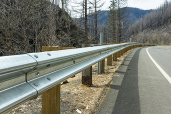 About
About
We could upgrade existing guardrail or add guardrail in locations where there are steep drop-offs or cliffs, deep ditches, or other roadside objects that can’t be moved.
Benefits
Guardrail provides a barrier on the side of the road that will prevent vehicles departing the roadway from hitting more dangerous objects, such as trees or steep slopes.
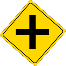
 Stop-Controlled Intersections
OR 126 provides direct access to many forest service roads, residential and recreational areas.
It's difficult for divers to see upcoming signs to be aware of vehicles entering OR 126 from the stop-controlled side streets.
Potential Solutions
Click on each tab below to learn more about potential solutions.
We don't have funding for these solutions as part of the study.
If funding became available, the cost and time it takes to implement would depend on the chosen solution.
Intersection Warning System – OR 126 Traffic
 About
About
We could install an intersection warning system so drivers on OR 126 know that there may be vehicles stopped ahead of them waiting to turn.
Benefits
Intersection warning systems flash lights alerting drivers that they may need to come to a stop ahead. This could help drivers know to slow down and drive more cautiously.
Intersection Warning System – Side Street Traffic
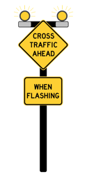 About
About
We could install an intersection warning system that flashes lights so drivers on OR 126 know that there is traffic on side streets that may enter the intersection.
Benefits
Intersection warning systems use flashing lights so drivers know there is traffic on side streets. This could help drivers know to slow down and drive more cautiously.
Improve Sight Distance at Intersections
 About
About
We could make changes at intersections along the corridor to help drivers see oncoming traffic better. This might include:
- Trimming trees that are blocking the view.
- Removing minor obstacles.
- Removing trees or fences.
- Rebuilding the roads at the intersection so it's easier to see farther.
Benefits
If drivers can see farther, they can make a more informed decision on when to turn onto OR 126.
Left Turn Lanes
 About
About
We could install left turn lanes at key locations in the corridor.
Benefits
Left turn lanes create a space for drivers to wait until it is safe to turn, removing them from the other traffic. Dedicated left turn lanes at intersections help reduce rear-end crashes.
Risky Driver Behavior
 The community shared concerns that drivers are going too fast, passing vehicles in unsafe ways, and sometimes driving impaired.
Nearly all of the fatal or serious injury crashes along the corridor involved at least one of the following risky driving behaviors:
-
Impaired driving.
-
Speeding.
-
Unsafe passing.
-
Careless or reckless driving.
-
Distracted driving.
Potential Solutions
Click on each tab below to learn more about potential solutions.
We don't have funding for these solutions as part of the study.
If funding became available, the cost and time it takes to implement would depend on the chosen solution.
Safe Driving Media Campaign
 About
About
We could develop a media campaign for safe driving. We could cover topics like:
- Speeding.
- Impaired driving.
- Passing opportunities and behavior.
- Setting expectations for travel time in varying conditions.
- Winter weather driving.
Benefits
If we increase driver awareness of their impacts on other drivers, they may be more cautious. We'd also be setting appropriate expectations for how to drive through the corridor.
Evaluate Funding Opportunities for Increased Enforcement
 About
About
We could evaluate funding opportunities to support more state, county and other local enforcement along the corridor.
Benefits
Increased enforcement in the area could encourage drivers to follow the speed limit and pass others appropriately. More responders would be in the area and be closer if a driver needed help.
Install Solutions to Encourage Safer Driver Behavior
 About
About
We could install signs, delineators and rumble strips to help encourage safer driver behavior. This could include:
- Wildlife warning signs.
- Signs to introduce access points like businesses or pedestrian/bicycle activity.
- Speed feedback signs so drivers know how fast they're going.
- Delineators.
- Rumble strips.
- Weather warning signs.
Benefits
By installing warnings, drivers would have notice of what they could expect along the corridor and may drive more cautiously.
 button in the upper left of the map window. (You may need to turn off layers to select other objects underneath.) Map shapes and icons are provided for reference only, precise locations may vary.
Click the "+" or the title below to view the information in each section.
Location
This segment includes the Walterville Canal Bridge and the OR 126 and Page Lane intersection.
Safety Issue
Between 2016 and 2020, there were seven reported crashes, with three resulting in a fatality or serious injury. The Walterville Canal Bridge is narrow and has raised sidewalk, creating a higher risk of fixed object and head-on crashes.
Potential Solutions
- Widen shoulders and install shoulder rumble strips.*
- Install centerline rumble strips.
- Install high-visibility striping.
*Solutions that require bridge widening would be very expensive and likely couldn't be implemented within the next five years.
Location
This segment includes the Leaburg Dam Spillway.
Safety Issue
Between 2016 and 2020, there were seven reported crashes, with two resulting in fatality or serious injury. Curves in the highway make it difficult for drivers to see oncoming traffic. Feedback from the community noted that drivers often speed along this segment. These factors combined create a higher risk of roadway departure crashes.
Potential Solutions
- Widen shoulders and install shoulder rumble strips.*
- Install centerline rumble strips.
- Install delineators.
- Install warning signs to guide drivers through the curve.
- Install high-visibility striping.
*Solutions that require bridge widening would be very expensive and likely couldn't be implemented within the next five years.
Location
This segment travels through Ben and Kay Dorris County Park and also includes a curve listed as a 2020 Safety Priority Index System (SPIS) site. This means that the curve’s location in this segment had one of the highest and most severe crash rates in the state for the previous three years.
Safety Issue
Between 2016 and 2020, there were 11 total crashes, with two resulting in serious injury. The main safety issues on this segment result from the narrow roadside and steep drop-off on the eastbound shoulder, which makes high-severity roadway departure crashes more likely.
Potential Solutions
- Widen shoulders and install shoulder rumble strips.*
- Install guardrail.
- Install warning signs to guide drivers through the curve.
- Install high-visibility striping.
*Widening shoulders in this section may have environmental constraints and would be very expensive so likely couldn't be implemented within the next five years.
Safety Issue
This intersection has an extensive history of crashes that resulted in a fatality or serious injury. Between 2016 and 2020, there were 21 total crashes. Four resulted in a fatality or serious injury. Nearly all were rear-end crashes in the westbound lane. The main safety issues are caused by:
- Lack of visibility. It's especially difficult to see westbound vehicles waiting to turn left onto Deerhorn Road.
- Unsafe speeding and passing behavior.
Potential Solutions
- Upgrade striping and signs to make the intersection more visible.
- Install an intersection warning system.
- Install a westbound left-turn lane.*
- Install an eastbound right-turn lane.
- Install roundabout.*
*Solutions that require bridge widening would be very expensive and likely couldn't be implemented within the next five years.
Safety Issue
Ross Lane was listed as a Safety Priority Index System (SPIS) site in 2019 and 2020, which means the location experienced one of the highest and most severe crash rates in the state for the previous three years. Between 2016 and 2020, there were a total of three with two resulting in serious injury.
This intersection is located on in a curve, making it difficult for drivers to see other vehicles when turning into and out of Ross Lane.
Potential Solutions
- Upgrade striping and signs to make the intersection more visible.
- Increase the visibility of the highway for drivers stopped on side streets.
Safety Issue
The main safety issues at this intersection are unsafe speeding behavior and lack of intersection visibility. There is a high risk of westbound rear-end crashes at this entrance to Holden Creek Lane. Between 2016 and 2020, there were a total of four reported crashes.
Potential Solutions
- Upgrade striping and signs to make the intersection more visible.
- Install an eastbound right-turn lane.*
- Increase the visibility of the highway for drivers stopped on side streets.
- Install high-visibility striping.
*Widening to provide a right-turn lane in this section may have environmental constraints, would be very expensive and likely couldn't be implemented within the next five years.
Safety Issue
At the east entrance of Holden Creek Lane, there were a total of four reported crashes from 2016 to 2020, with one resulting in a fatality. Two of the four crashes happened when it was dark outside.
The main safety issues at this intersection are the lack of signs and poor visibility.
Potential Solutions
- Upgrade striping and signs to make the intersection more visible.
- Install intersection lighting.
- Increase high-visibility striping.
Safety Issue
This intersection is located near several local businesses in Leaburg. Between 2016 and 2020, there were a total of six crashes, with one resulting in serious injury.
Potential Solutions
- Upgrade striping and signs to make the intersection more visible.
- Install intersection lighting.
Safety Issue
This intersection is located in a curve, which makes it difficult for drivers on OR 126 and Goodpasture Road to see vehicles entering the intersection. The one-lane covered bridge on Goodpasture Road makes it even harder for drivers on OR 126 to see other vehicles.
Between 2016 and 2020, there were a total of three crashes, with one resulting in a fatality.
Potential Solutions
- Upgrade striping and signs to make the intersection more visible.
- Install flashing beacons that turn on as vehicles approach to warn other drivers.
Click the "+" or the title below to view the information.
Small Community Toolbox
Some of the solutions we could implement, while others could be implemented by each community. The list of potential solutions includes:
- Signs to notify drivers they are entering a community.
- Radar speed feedback signs to encourage lower speeds.
- Enhanced pedestrian crossings.
- Shared center left-turn lane for both directions of traffic.
- No-passing zones in or near each community.
- Narrowing travel lane widths.
- Road and intersection lighting.
- Sidewalks or paths for walking.
- Bike lanes or paths for cycling.
- Strategies to help reduce conflicts between traffic and turning vehicles.
- Collecting and evaluating travel speeds.
- Setting consistent speed limits in all small communities.
Stay Connected
 You can always learn more about the project, find out about upcoming events and stay connected by visiting the project webpage.
 If you have not already, sign up to receive future updates about this project.
Please help us spread the word about this online open house.
Feel free to share this with your friends and neighbors so that we can get their feedback.
Thank you for participating!

Click the "+" or the title below to view the information.
OR 126: Greenwood Drive - Vida Paving
About
We're grinding and removing the top layer of the road surface and replacing it with a brand-new layer of asphalt.
This work will help restore the strength of the road and create a smoother ride.
Impacts
We started construction this year – for the most up to date information visit TripCheck.com.
You can expect delays, shoulder and lane closures. A combination of flaggers, automated flagging devices and pilot cars control the work zone.

Sign up to receive email alerts to learn more about our construction work in Lane County.
Visit the project webpage.
Click on each tab below to learn more about the projects.
OR 126: Linn County Line to Old McKenzie Highway Paving
About
This section of OR 126 is in a snow zone and the current pavement is cracking and needs to be replaced. The pavement is in poor condition and has required our maintenance crew to apply patches more frequently to hold this section together.
We will:
- Remove the existing pavement.
- Repave.
- Apply permanent striping.
- Adjust or replace the guardrail.
- Apply a new driving surface to bridges in the project area.
By repaving, we're creating a smoother ride and preserving the road so more costly repairs are not needed in the future.
Schedule
We are currently designing this project and estimate construction starting in 2024. When construction starts, expect some nighttime lane closures.
Sign up to receive email alerts to learn more about our construction work in Lane County.
Visit the project webpage.
Rumble Strips
About
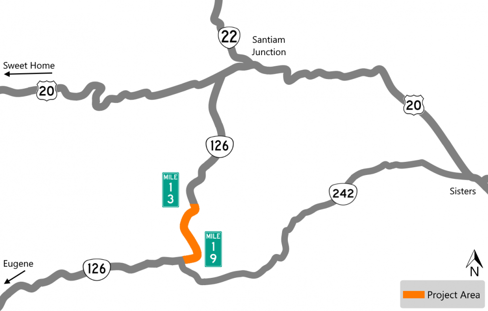
This section of OR 126, milepost 8.5 to 19.8, has a high frequency of fatal and serious injury lane departure crashes. With this project we're installing rumble strips at this location and other highways in the Willamette Valley and along the north coast.
Rumble strips are grooves in the pavement that create vibration and sound to alert motorists when leaving a lane. Rumble strips can reduce the number of roadway departure fatalities (by 20%) on the targeted highway segments, making them a successful, low-cost countermeasure.
Schedule
We are currently designing this project and estimate construction starting in 2024.
Sign up to receive email alerts to learn more about our construction work in Lane County.
Visit the project webpage.
Curve Warning Signs
About
We're upgrading curve warning signs to meet current standards and installing new signs as needed on OR 126, milepost 0 to 76.7.
In some cases, suggested speed signs may be removed, added or the suggested speed may be increased or decreased.
Installing signs help reduce fatal and serious road departure crashes at curves. Curve warning signs have been shown to aid in driver's awareness in the changes to the direction of the road and to decrease road departure crashes. Road departure fatalities account for about two-thirds of Oregon fatalities.
Schedule
We are currently designing this project and estimate construction starting in 2024.
Sign up to receive email alerts to learn more about our construction work in Lane County.
Visit the project webpage.
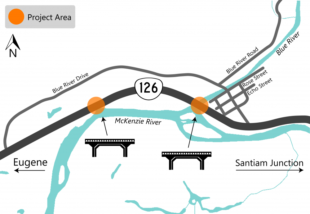
OR 126: Blue River and Fish Hole Bridges
About
West of the town of Blue River on OR 126, the surface of two bridges are in bad condition resulting in a rough ride. We’re designing a project to restore the surfaces of the bridges before they get worse.
We are:
- Removing the existing concrete.
- Replacing the concrete.
- Providing a smoother surface for drivers.
- Upgrading guardrail.
During construction, traffic will be controlled by temporary signals to help keep travelers and our construction crew safe.
Schedule
We are currently designing this project and estimate construction starting in 2024.
Sign up to receive email alerts to learn more about our projects on OR 126 from Eugene to U.S. 20.
Visit the project webpage.
In-Person Open House
Your feedback is an important part of our process and will help make sure we're designing the right project for your community.
Stop by our in-person event to learn more about the study, projects we're constructing this year and projects in design.
-
When: Thursday, July 13 from 6 p.m. to 7:30 p.m.
Drop in at any time! -
Where: McKenzie Fire and Rescue Station
42870 McKenzie Hwy, Leaburg, OR 97489.
We hope you can stop by. Please let us know if you need accommodations to attend.
Add the In-Person Open House to Your Calendar
Add to Google Calendar | Add to Outlook.com Calendar | Download and add to Apple Mail or Outlook Desktop Calendar
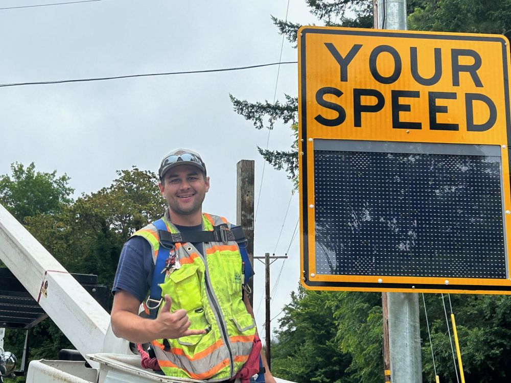
Thank You Joel Zeni
For donating and installing six speed feedback signs for three 45 m.p.h. zones on OR 126 east of Springfield.
Read more about the donated signs in a recent McKenzie River Reflections article.
The photo shows Joel installing one of the speed feedback signs that he donated.